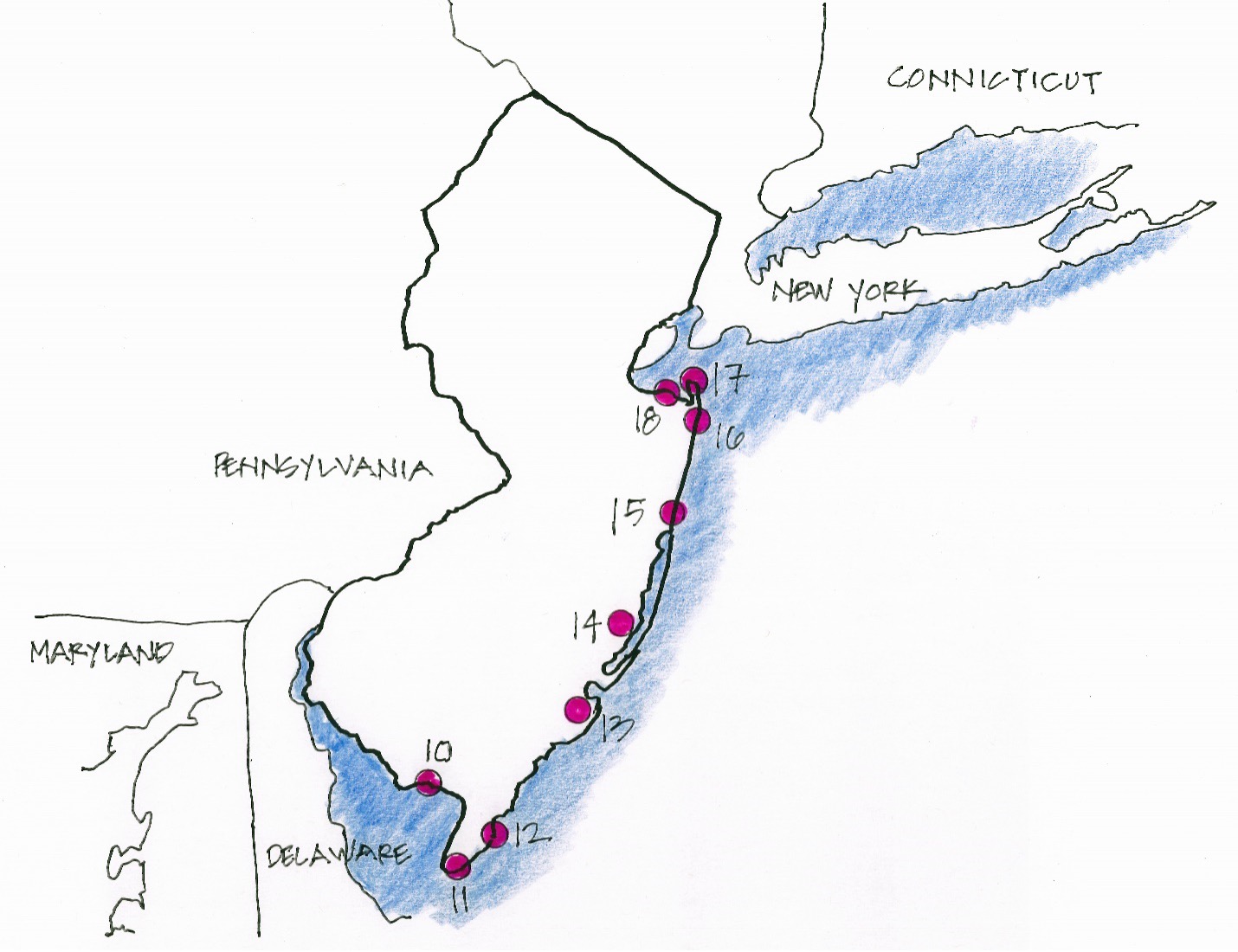
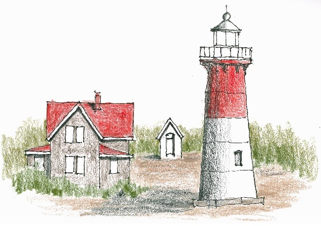
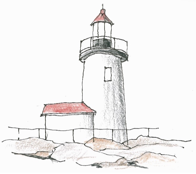
Maine

Maine Road Trip Part 1: Wisconsin, Illinois, Indiana,West Virginia, Virginia, Maryland
Day 1 Friday
Madison, Wisconsin, for the night
Leaving early on August 2nd, I drive south to Hudson, Wisconsin, where I join I-94. Profuse White Pine, Oaks andMaples—sometimes like driving through a tunnel. I spend the night at high school classmate Carole and her husband Dick’s. Always a good reunion.
Day 2 Saturday
Indianapolis, Indiana, for the night
After a couple cups of coffee and an English muffin with grape jelly, I’m on the road again. iMaps routes me around Chicago and on to Indianapolis. I opt for a quiet dinner at the Fujiyama Steakhouse—shrimp tempura and egg rolls, cheesecake for dessert.
Day 3 Sunday
Charleston, West Virginia, for the night
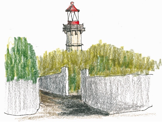
Easy drive to Charleston, West Virginia—all ups and downs. Sketch the courthouse in 96 degree humid and sweaty weather. Try theFujiyama again, and order the same thing but with poor result—never expect the same result twice—but it was quiet like last night.
Day 4 Monday
Reston, Virginia, for the night
Through the beautiful West Virginia countryside which fanned out in the fog like a Japanese painting. In Reston, Virginia, Istay with Janet, a work colleague from long ago. We have dinner with her daughter Joann and grandson Andy.
Day 5 Tuesday
Baltimore, Maryland, for the night
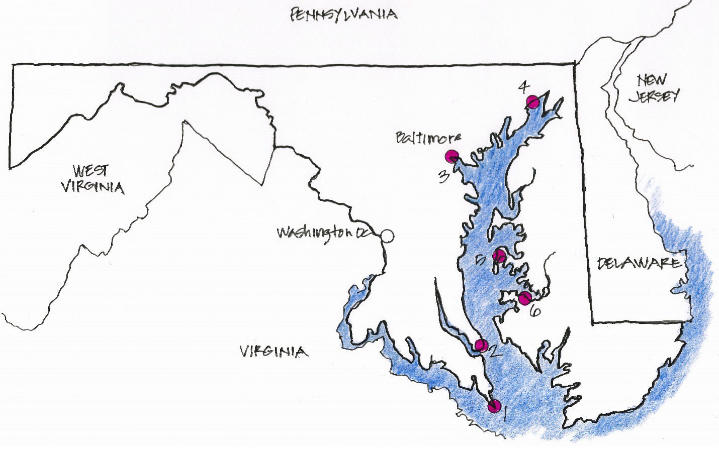
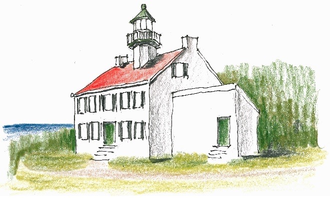
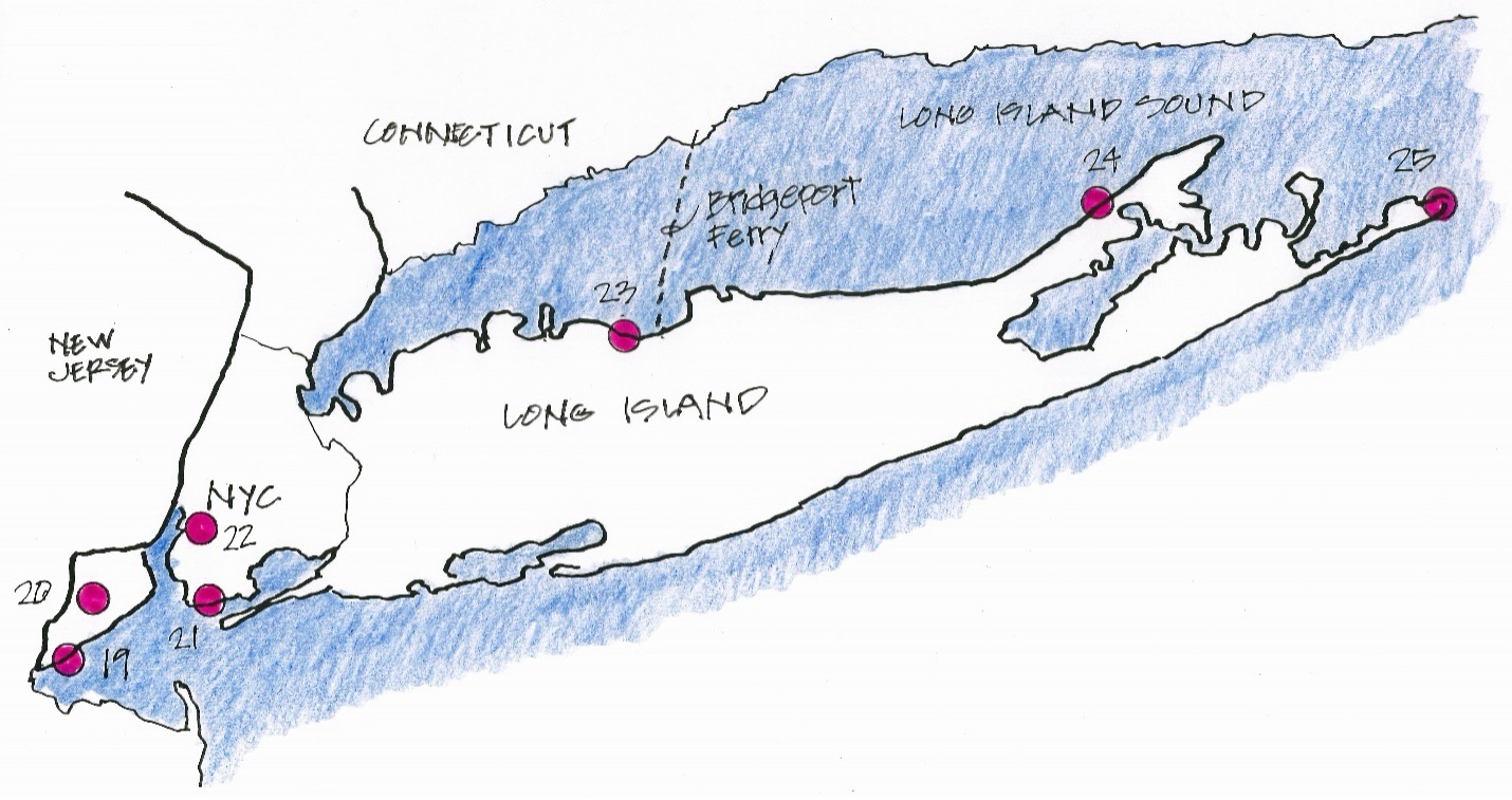
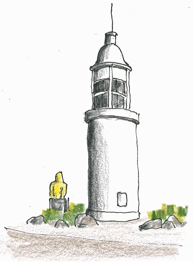
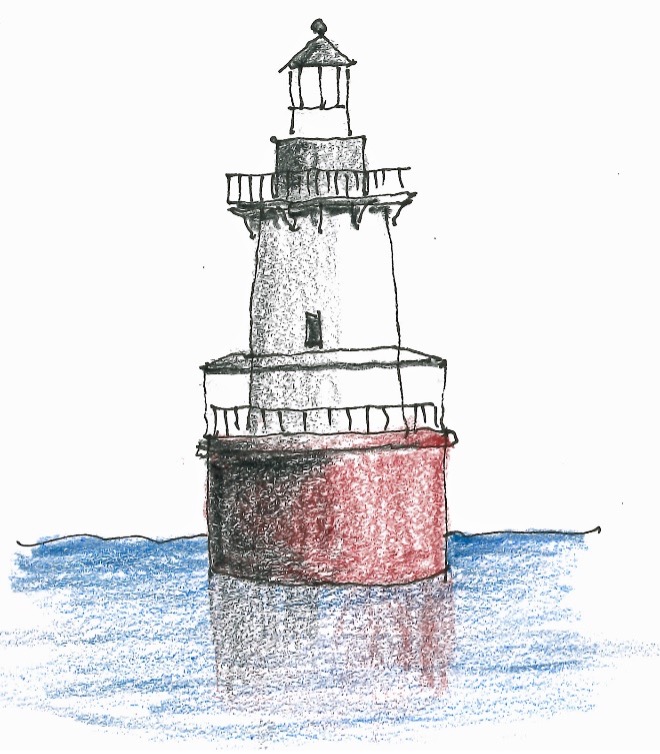
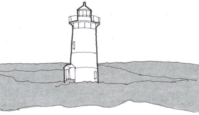
Miraculously I find my way through the freeway fandazzle of Washington, DC, and down to the Point Lookout Lighthouse at the southernmost tip of Maryland’s shoreline along the west side of Chesapeake Bay.Maryland is almost all shoreline—3,000 miles and more.
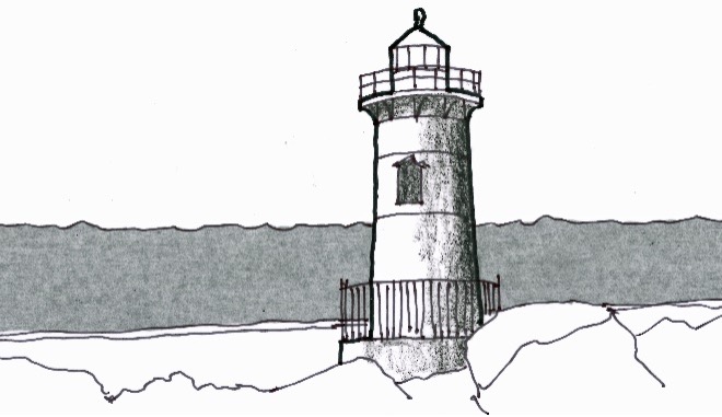
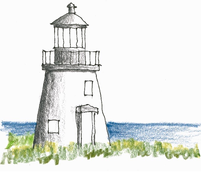
Driving up the shoreline I find Drum Point Lighthouse at the Calvert County Marine Museum. I take a seat at a shady picnic table and sketch the spindly lighthouse. You can tell I haven’t sketched for a while—even sketchier than usual, but they’ll get better with practice.
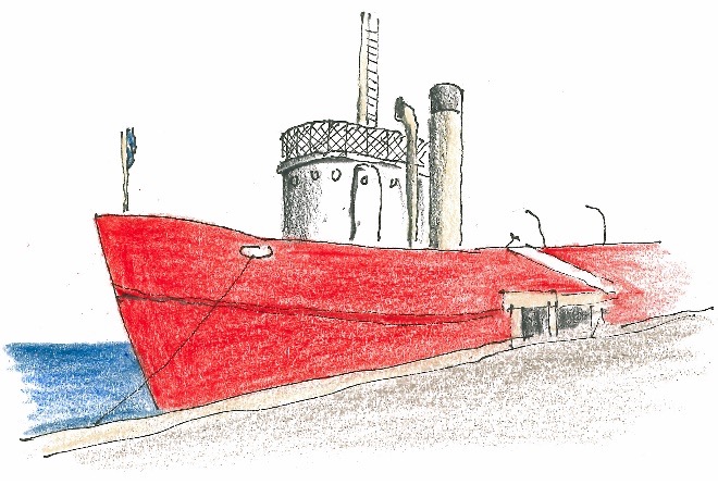
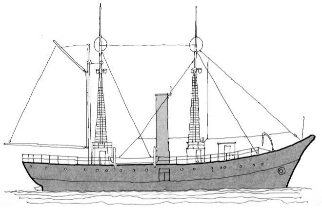
I drive up to Baltimore and get there just at rush hour. Driving around looking for the Lightship Chesapeake is your worst nightmare, so I head for the Holiday Inn Express. No scratches or scrapes on the Q5—just gotta be assertive and ignore the rude horns.
G & M Restaurant (where the motel clerk used to work) is full to the brim so I take a seat at the bar next to a big guy with big hair out to here. He’s younger than I am, but not by much, and he looks like a regular. When he orders a special kind of Old Fashioned, I say, “I’ll have what he’s drinking.”
Bill and I strike up a conversation and find we both like Lagavulin Scotch. That’s a start. We exchange cards. Turns out he’s a professional photographer—www.focipictures.com. Always nice to have someone you can relate to for a chat over dinner.
Day 6 Wednesday
Cambridge, Maryland, for the night
In the morning, I drive downtown, and find that unlike last night, there’s no traffic in Baltimore’s tourist district. The Lightship Chesapeake floats right next to the National Aquarium, and I find a parking place on the street. I set up my folding chair and enjoy the smell of freshly mowed grass—especially enjoyable because I didn’t have to do the mowing.
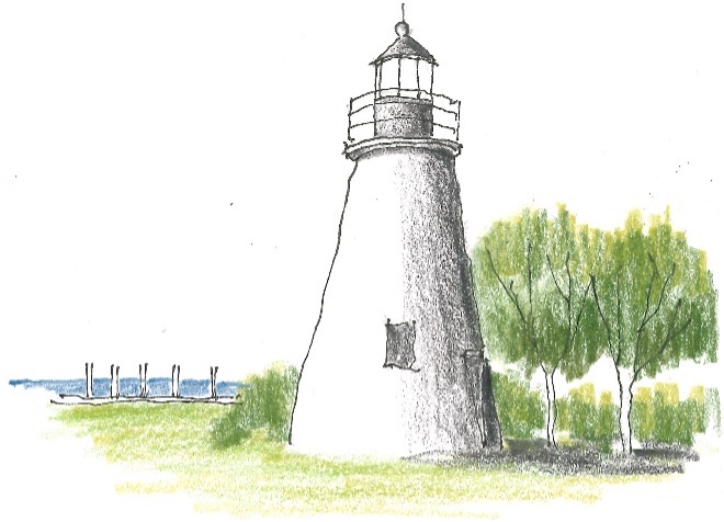
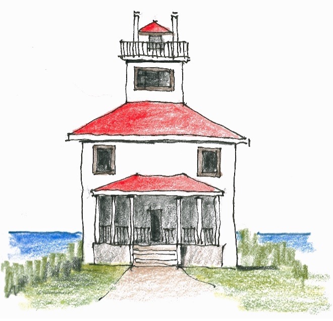
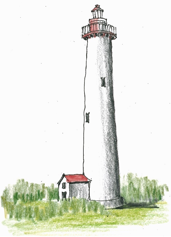
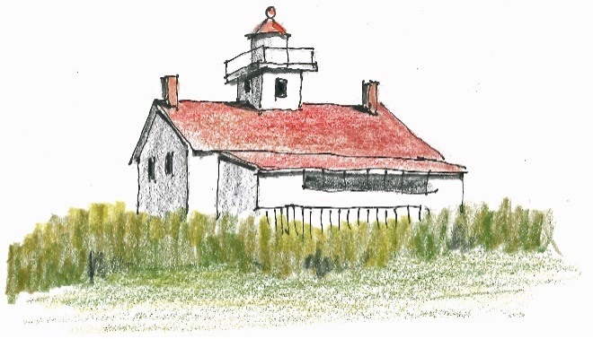
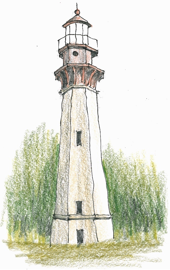
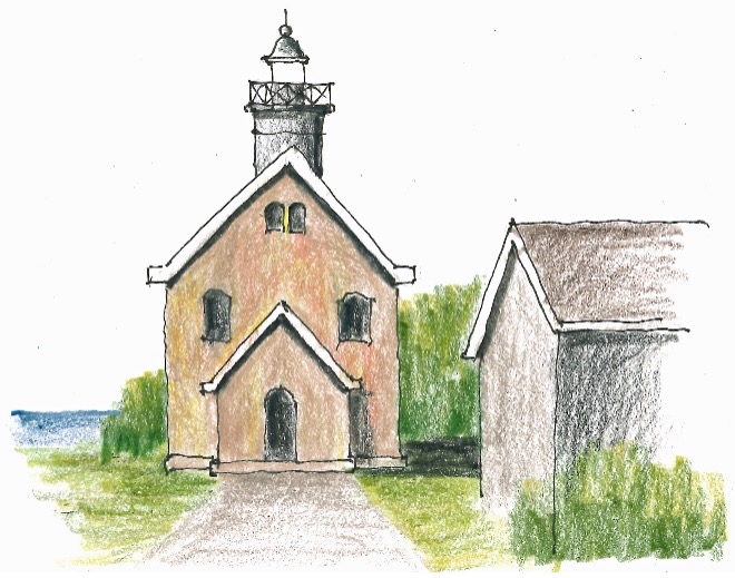
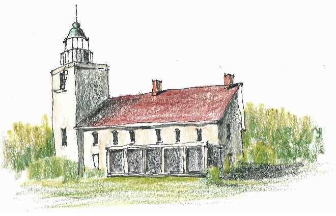
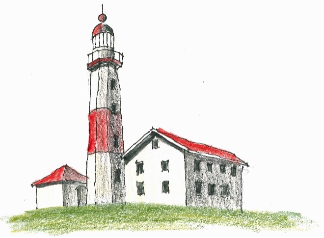
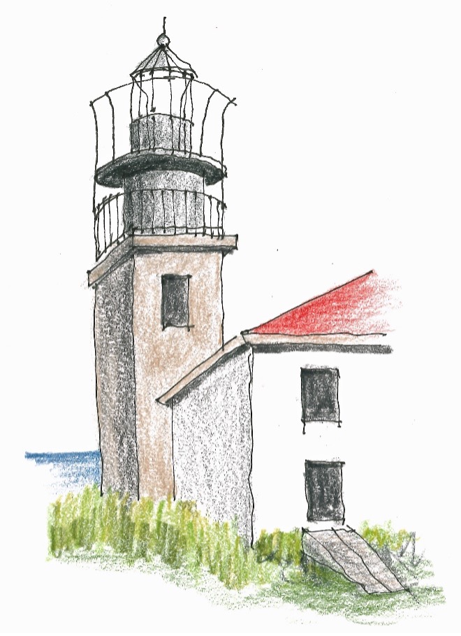
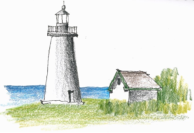
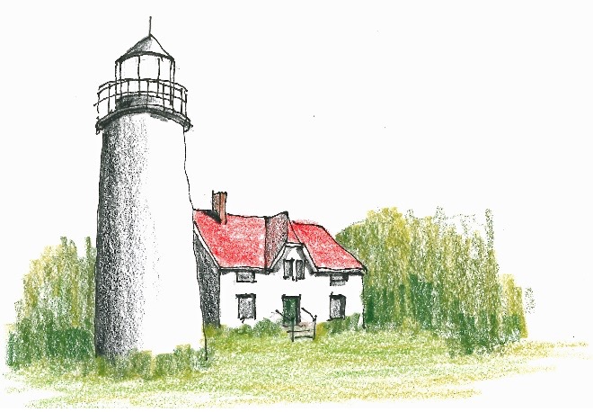
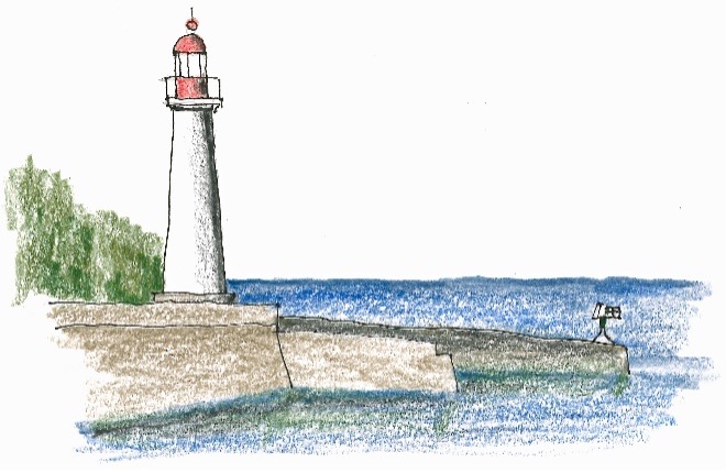
Heading northeast out of Baltimore on US-40 it takes 45 minutes to arrive at Havre de Grace, Maryland. I love that name—haven of grace. It’s where the Susquehanna River empties into the Chesapeake Bay. I tour the top-notch museum at Concord Point Lighthouse with its white painted granite walls nearly four feet thick at the base and black painted nine sided lantern room. But storm clouds are looming—Hurricane Debby is on its way.
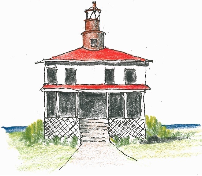
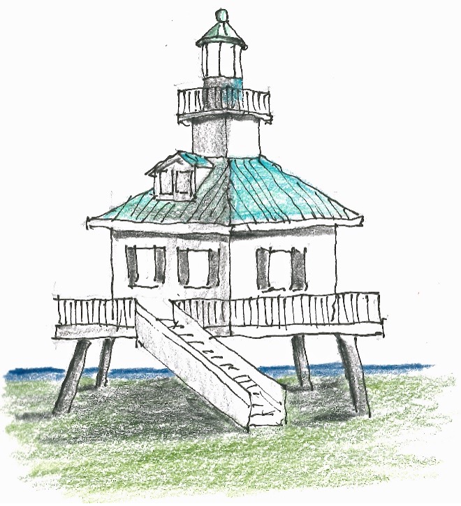
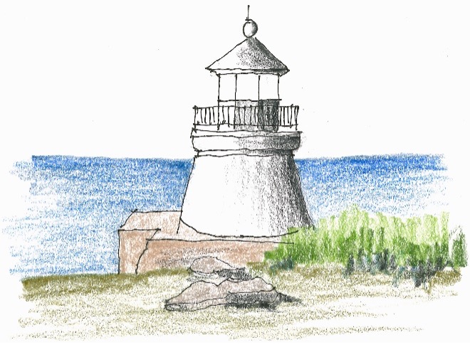
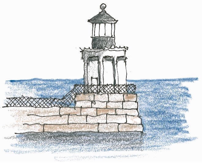
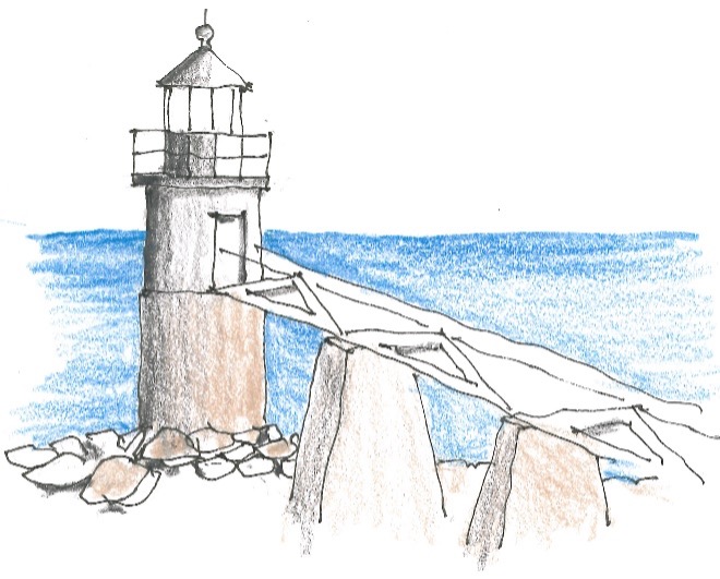
I’m worried about my time schedule—planning an itinerary for a trip like this is fraught with unforeseen difficulties (UFDs)and not exact—so I bypass the lighthouse at Turkey Run and shoot right on down to Hooper Strait Lighthouse, in St Michaels, Maryland, another hard to sketch guy on stilts.
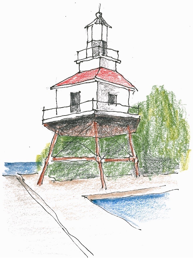
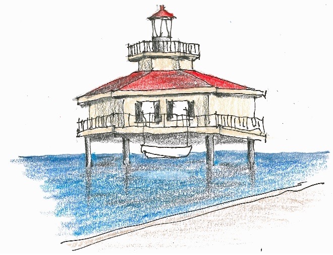
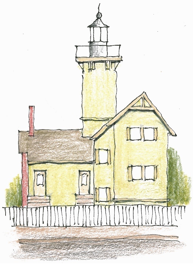
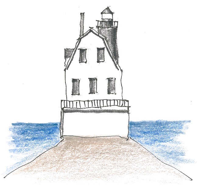
Back on US-50, it’s just 26 miles to Cambridge and Choptank River Lighthouse. It would be the last of the spider style lighthouses, thank God for that.
Dinner downtown Cambridge at the Blue Ruin, a curious name for a restaurant—archaic slang for cheap homemade gin. I have an amazingly good salad with arugula, feta, watermelon, basil and mint herb oil, and balsamic reduction. Now that’s a mouthful. I also have the crabcake po boy. I’m told Maryland has the best crabcakes, and I can give my affidavit to that.
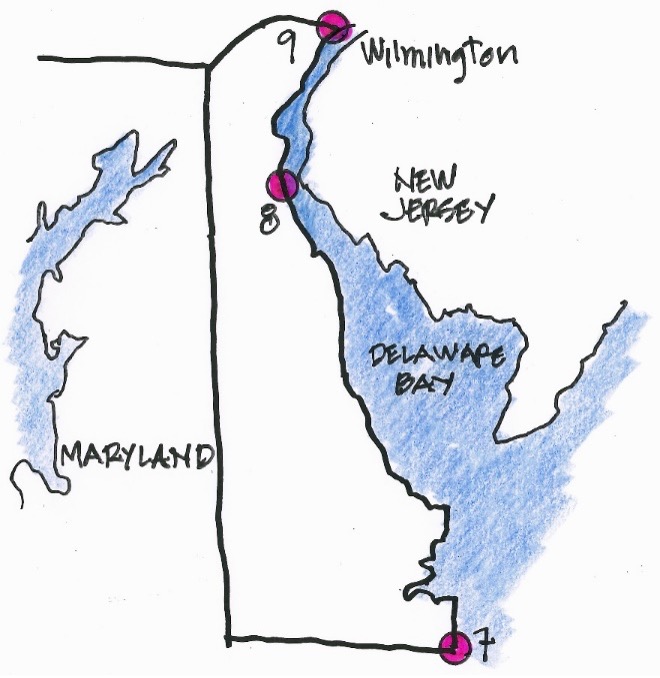
Part 2: Delaware
Day 7 Thursday
Wilmington, Delaware, for the night
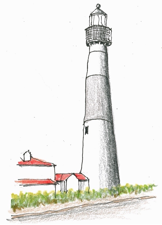
Winding my way on US-50 east for a little over an hour across Maryland, I get to Fenwick Island Lighthouse which sits just across the border in Delaware. It lights the way from the Atlantic Ocean intoDelaware Bay.
Heading north I decide to skip some more lighthousesbecause they’re out in the bay and pretty inaccessible, or just boring skeleton frames, but Liston Front Range Lighthouse is a cute place.
Inclement weather sets in, but it lets up enough soI can sit in the middle of a residential neighborhood and sketch Marcus Hook Rear Range Lighthouse. If you look closely at the chimney of the house in the sketch, you can see what a raindrop does to my inkwork. The cast in place structure just sits there unobtrusively.
Rain pours down as I arrive at the Holiday Inn Express (HIX) in Wilmington, Delaware. It would be the only one I encounter without a drive under canopy, but I have an umbrella. Dinner at the Olive Garden right next door—Eggplant Parmigiana and salad, just like I’d never left Minnesota.
Part 3: New Jersey
Day 8 Friday
Woodridge, New Jersey, for the night
Now the lighthouse sketching begins in earnest. New Jersey has 19 lighthouses on offer. I’m up at 7:00 and make an executive decision to bypass my reservation at the Court Marriott Beach in Atlantic City—Hurricane Debby is moving up the coast. Instead, I change my booking to two nights at the HIX in Woodridge, New Jersey.
Then I double time it down New Jersey’s Delaware Baycoast and stop at East Point Lighthouse which is maintained by the Maurice River Historical Society.
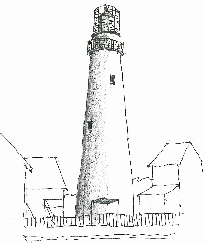
Next in line is the tall Cape May Lighthouse which sits in a state park—luckily there’s no entry fee. It sits at the southwest corner of New Jersey.
The Cape May Lighthouse played a role in the Underground Railroad which helped slaves escape from the slave states of Delaware, Maryland and Virginia. In 1858 slaves rowed across Delaware Bay in a skiff and 1860 in a Batteau and were guided by the lighthouse.
Just up the coast is the quaint Herford Inlet Lighthouse, in North Wildwood, New Jersey. It has both a museum and a bookstore. I plop down my chair and set up on the sidewalk across the street, sketch, walk through the garden, and tour the museum.
In less than an hour I’m in Atlantic City, but Debby is holding off. I set up camp in an abandoned lot well away from the beach and sketch Absecon Lighthouse. The neighborhood seems sketchy, but I sit right next to my vehicle in case I need a quick getaway. Had to kick a couple bottles out of the way.
Looks like rain. Strong winds prevail. Just up the road is the replica of Tuckers Island Lighthouse. However, the nearby museum is closed up tight. Not a soul around. I take shelter under the eaves.
Just up the coast is the seaside town of Sea Girt.There’s a restaurant on the beach side of Sea Girt Lighthouse, so I can stay dry while sketching. Out in the street half a dozen uniforms stand around in rain coats. I ask, “What’s going on?”
“We anticipate some rowdiness at the Parker House.Lots of people celebrate on Friday nights.”
I race on up to Woodridge and check into the HIX.Mulberry Street Restaurant is recommended, and I make a reservation. It’s aneighborhood Italian place—can’t beat that. Everybody seems to know everybody.A Martini is in order to celebrate a long day. The entire Eastern Seaboard isunder a tornado alert due to Debby.
Day 9 Saturday
Woodridge, New Jersey, for the night again
Sunshine! Blue skies! Egg McMuffin with OJ and coffee because there’s no complementary cinnamon roll and coffee at this HIX. I head back tracking down to Navesink Lighthouse which is a double lighthouse with a marvelous museum. I plop my chair down on the sloping grass lawn but not too close to the edge of the bluff. I have a nice chat with the husband and wife who are volunteering in the gift shop.
Part 4: New York
Day 10 Sunday
South Jamaica, New York, for the night
This is a big day. Not only New York City, but also the start of a side trip with my granddaughter Kathryn to visit colleges fromManhattan to Boston.
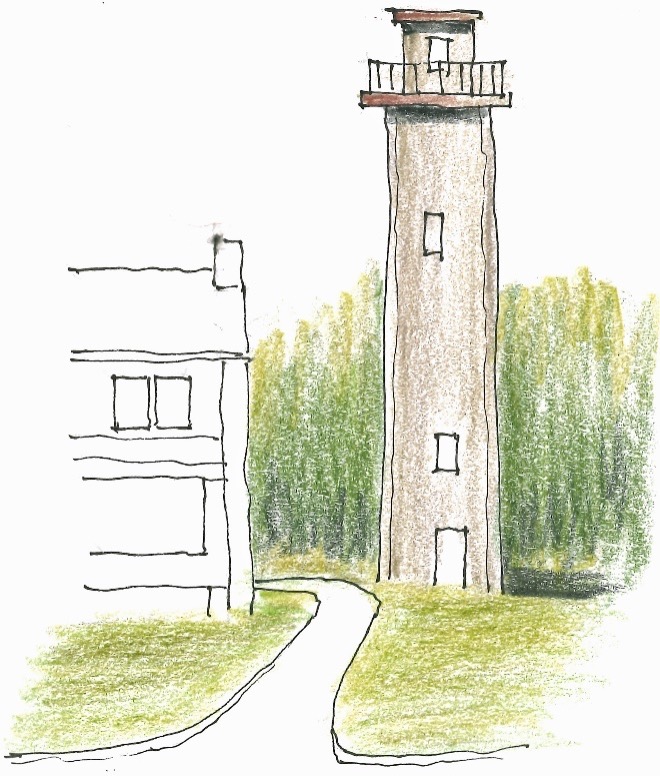
I rub the sleep out of my eyes as I drive alongmunching a cinnamon roll and swilling coffee from the HIX in Woodbridge, NewJersey. In 20 minutes I’m in Staten Island, a borough of New York City itselfbut separated by the Narrows and the Upper Bay. A long walk takes me up to Princess Bay Lighthouse where I’m alone. Even without the lantern room it’s an impressive edifice, and my sketch doesn’t do it justice. Maybe the walk wore me out.
Following Google Maps, next thing I know I’m in a pretty posh neighborhood on Richmond Hill in Staten Island. The nicely designed Staten Island Range Lighthouse sits right between a couple splendid houses, one of which was the keeper’s place.
I hop onto I-278 and drive across the Verrazzano Narrows Bridge—when it opened in 1964, it was the world's longest suspension span at 4,259 feet.
I’m in Brooklyn in half an hour as I exit the bridge, light traffic on a Sunday. Getting to the Coney Island Lighthouse isa disappointment, however, because it’s in a tony gated community. The gatekeeper won’t let me in. The lighthouse is barely visible, but I sketch what I can see anyway.
On to South Jamicia in Queens where I check into afancy Marriott JFK—no HIXs around here. The hotel sits on a plot of ground withtwo other motels right smack dab in the middle of a nice residential area. Wellkept single and duplex dwellings surround the site.
After checking in I drive over to SpotHero SecureParking and drop off my car for safekeeping while I’m on my excursion withKathryn. It’s a pretty dicey place, and I have some apprehension but no other choice. SpotHero shuttles me back to the hotel. I walk into the high caliberrestaurant, The Quimby, and launch into a superb Martini followed by a porkchop with brussels sprouts and other good stuff.
Day 11 Monday
Manhattan, New York City,for the night
My vacation within my roadtrip starts. After breakfast at The Quimby, the hotel shuttle takes me to the Delta terminal atJFK International Airport where I meet Kathryn as she comes in from the Twin Cities. We collect her checked luggage, take the AirTrain to Jamaica, jump on the subway, and are shortly in Greenwich Village, Manhattan, about a block fromWashington Square Hotel where we’ll spend the next couple nights. Public transport is so splendid.
At 3:00 we meet up with the NYU tour group at the corner of Washington Square. After an afternoon of being touted, we take a taxit o Delmonico’s in the financial district. Some of you may remember the Gunsmoke TV series—Matt, Kitty and Chester ate at Delmonico’s all the time.
Kathryn’s dressed to the nines, and I’m in my fancy new safari jacket. Right away, at Kathryn’s suggestion, we save $200 by not ordering the caviar. I have the Faroe Island salmon and Kathryn has the best ever lamb chops.
I remind her that she was only ten when Gram (my wife Sheryl) died, and therefore, she missed some of Gram’s etiquette lessons.So, I explained the intricacies of communal bread and butter—most people don’t respond well to my advice, but she’s thankful.
We share a baked Alaska. What a perfect evening.
Manhattan, New York, for the night again
We breakfast at the Waverly Diner, and for a taste of Manhattan, Subway up to 110th Street and walk past and take a look inside the Cathedral Church of St John the Divine which has been under construction since 1892. The Columbia campus now has controlled entrances at116th Street, but it’s still my old stomping grounds.
After the tour we walk up Claremont, have a bite, and check out the apartment building where I lived with my family when I was a graduate student here. In the evening, we dine at the Kit Kat Club on West 52nd Street and see the best show on earth, Cabaret. I’ve never seen a performance to top this one. Only downside: I forgot to repossess my Leatherman from the box office.
New Haven, Connecticut, for the night
In the morning Kathryn follows the subway map we gotat the hotel and routes us to Fifth Avenue. We walk up past what was theTishman Building where I worked two days a week while at Columbia. TheGuggenheim invites us in, but the Met is closed on Wednesdays.
Kathryn suggests a walk across Central Park. It’s a sweltering day walking up and down hill. We stop for a basket of watermelon slices, no drinks offered other than sugar water.
Then a cab down back to our hotel and another to theMoynihan Station. While I’m walking around looking for lunch, our train is announced. Katheryn rounds me up and saves my bacon. We Amtrak to New Haven, check into the New Haven Hotel, and eat at the South Bay Mediterranean Kitchen.Note: If you want good crabcakes, order them in Maryland not Connecticut.
Day 14 Thursday
Boston, Massachusetts, for the night
I’m up early for a walk around the Yale Campus to see Paul Rudolf's corduroy Architecture Building. Rudolph chaired Yale’sDepartment of Architecture for six years. Completed in 1963, his design was one of the earliest and best known examples of Brutalist Architecture. In my view this was one of the worst styles—architecture should be friendly not Hitler-esque.
Unlike Manhattan, a breakfast place is tough to find, but we manage some coffee. Kathryn is delighted with the Yale tour. Infact, it’s her go to college if they accept and fund her. She’ll graduate high school with two years of college and an associate degree under her belt. After hiking back to the station, we board Amtrak for Boston.
Frightfully expensive rooms at the HotelCommonwealth, but they give us free aluminum water bottles. Dinner is right next door at the Blue Ribbon Brasserie. There’s even a plaque on the wall commemorating the architect, Peter Guzy of Asfour Guzy Architects. It’s a lovely last dinner together.
Day 15 Friday
Manhattan, New York, for the night
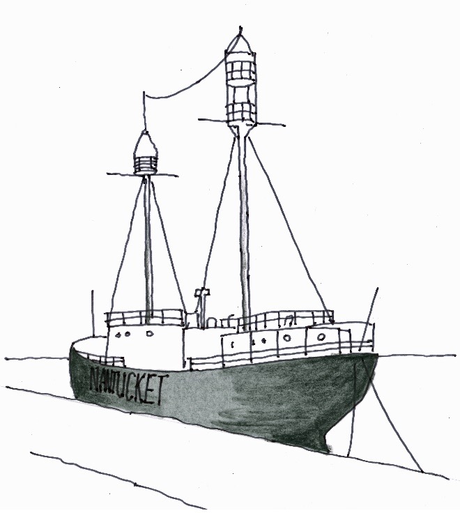
After touring Boston University I deposit Kathryn atLogan International and Uber down to the docks to look at the Lightship Nantucket. I finally find someone who knows where it is and snap a couple pictures. Not a place I want to hang around and sketch.
I Uber to the SouthStation, board the Amtrak, do some reading and dozing, and before you know it,I’m at the Washington Square Hotel. Excellent black bass dinner just around the corner at Loring Place—Kathi, Mark and I used to eat at the Loring Café next to Loring Park in Minneapolis whenever Mark was back from Seattle.
Day 16 Saturday
South Jamaica, New York, for the night
I have breakfast at a little place attached to the hotel. It’s only open on weekends and nicer than the Waverly Diner—three cups of coffee, three strips of bacon, and three pumpkin almond pancakes with real maple syrup.
Then Uber, this time to Fulton Street and the South Street Seaport Museum where I sketch not a real lighthouse but the Titanic Memorial Lighthouse.
A little further on is the Light Vessel (LV) Ambrose, and I’m delighted to be given a personal guided tour.
I subway up to 181st Street for a lunch of lemonade and toasted bagel. Lunch is sometimes payment for using the men’s room. What I really want up here is a sketch of Jeffrey’s Hook Lighthouse—also known as the Little Red Lighthouse—which sits right under the GeorgeWashington Bridge. But alas, my Uber driver can’t get us there. She makes a valiant effort but it turns out the exit we needed was closed off. She doesn’t charge me—New Yorkers can be nice.
It’s subway back to the Fourth Street and Sixth Avenue Station, reclaim luggage at Washington Square Hotel, subway to SouthJamaica, Uber to the Marriott JFK, stow luggage in my room, and walk into The Quimby. Whew!
The server remembers me, in part because last time I gave him a card with the Martini recipe on it—I always order Martini’s this way[frosty Martini glass, ½ ounce Dolin Vermouth, 3 ounces Sapphire gin, shake vigorously 25 times, twist of lemon peel] saves a lot of confusion. I order the same thing I did the week before and with good result.
A day of riding around and not much sketching. I reflect on Kathryn whom I’ve gotten to know on this trip, not a teenager anymore. She has the drive, energy and ambition to match her intelligence.
Tomorrow Long Island and Montauk.
Day 17Sunday
Riverhead, New York, for the night
Breakfast at the Quimby where the morning server also remembers me—coffee, orange juice, muffin. Then shuttle to retrieve my Q5from SpotHero. It’s there and unscathed—what a relief! They give me directions to get onto eastbound NY-27, and I’m off and running, but in the rain.
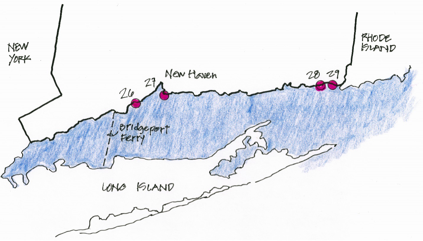
First stop is Old Field Point Lighthouse not far from the Bridgeport Ferry which I’ll be taking in a couple days. I sketch from inside the car due to drizzle. Wet sketchbook doesn’t have much tooth.
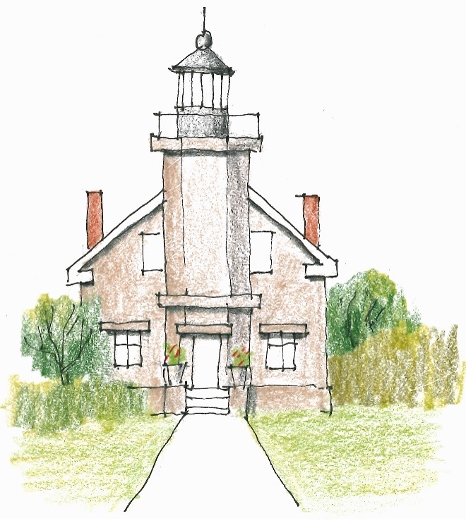
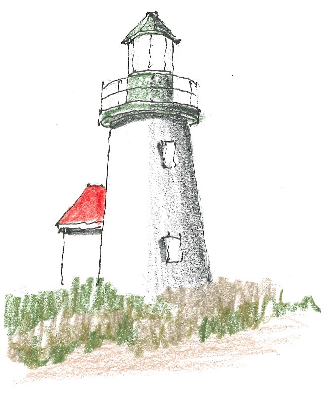
I detour past Riverhead, New York, where I’ll spend the night. I want to sketch Horton Lighthouse on Long Island Sound. Tomorrow I can sketch Cedar Island and Montauk Point Lighthouses and get back to Centereach, New York, at a reasonable time.
There are three or four volunteers at Horton, and the rain has stopped. I take the tour and we chat. They advise not heading out to Montauk until after nine in the morning because of heavy construction traffic earlier. Local knowledge is so helpful. I set up out on the lawn and sketch.
I do laundry at the HIX Riverhead but forget thesoap. Can you believe that? Yikes! Dinner at the Dark Horse. Oysters helped along by a brandy old fashion, crème brulée as reward. Chatted with Kathi and Mark on the phone, so nice. It’s not that I’m homesick, but I do miss family—18 days out. The has rain stopped.
Day 18 Monday
Centereach, New York, for the night
This morning, I start hiking out to Cedar IslandLighthouse. My information says half mile hike, but after 45 minutes I pass asign saying ‘Cedar Island Lighthouse one half mile.’ I do an about face andhead back to the car. I’m on the clock here—reservations have been made at theStony Brook HIX and I’d like to arrive by early evening.
I’m eager to get back to Sag Harbor and rejoin NY-27, but at this point my navigation up and quits. I’m going to have to ask for directions. I ask and ask and ask, but continue to get lost in this tangle of back roads. I’m drastically discombobulated, and stomach acid is flowing for sure.
Finally, I hail a guy who says, “Hey, I’m going to Sag Harbor. Just follow me.” He guides me to downtown Sag and signs to NY-27.If he hadn’t come along, I’d probably still be there, just a skeleton slumped over the wheel. Good people out on Long Island.
Montauk Point Lighthouse is only 30 miles from Sag Harbor, and I’m there in a flash. Lots of visitors. I unfold my chair, sit, and make a sketch. A couple Japanese women ask if they can each have their pictures taken in my chair—why not? I got a favor this morning and payback makes me happy. Also, it’s also good for international relations.
The Montauk Museum is world class, filled with storyboards and artifacts—the best lighthouse museum I’ve ever seen, and I’ve seen a lot.
Ancestors of the Montaukett Native Americans arrived here 10,000 years ago and domesticated corn, beans and squash. They occasionally hunted whales in their 40 person dugout canoes. They became some of the most fearless crewmen on early 1800s whaling ships out of Sag Harbor.
As I backtrack two hours to Centereach, the rain begins in earnest. I pull into the Stony Brook HIX at a reasonable time. It sits right next to Stony Brook University, and a lot of the guests here are parents who’ve brought their kids to start school. I chat with Kathi and Mark on the phone. It’s not that I’m homesick, just lonesome. I do miss family.
The parking lot outside the Dark Horse is a lake. I order a prosecco, to celebrate a trying and tiring day, and Mussels Luciano. Last night in New York, sad to see it go and especially my time with Kathryn. Tomorrow Bridgeport Ferry to Connecticut.
Part 5: Connecticut
Day 19 Wednesday
Norwich,Connecticut, for the night
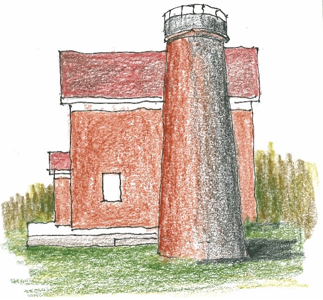
The Bridgeport Ferry is easy to find, but I’m the last to board. As we chug across Long Island Sound, I sit in the car and sort out my maps and papers and stuff. Out of the chute I head for Stratford Point Lighthouse. A chain link fence surrounds the entire property, but fortunately I’m sketching and not photographing—so I leave it out but include the picket fence. The tower wears an attractive red waistcoat.
Then a 30 mile drive to New Haven. No campus tour this time, just a sketch of Five Mile Point Lighthouse, looking lonely—not a soul around.
It's a 50 mile drive on I-95 from New Haven toGroton. Avery Point Lighthouse is embedded in the University of Connecticut Campus and a little tough to locate. I ask an older couple who are walking along the road, probably grandparents of a student here. They don’t know for sure, but their directions are good enough for me.
Under a blue sky with some scattered powder puff clouds, I pull into the reserved parking lot at the Bradford Banquet Hall. I unfold my chair on a well manicured lawn. Down by the lighthouse stands a woman in a white gown with a bouquet of flowers and a man in Navy dress blues. Lots of cameras clicking—must be a wedding. I’ll bet old Avery Point Lighthouse gets in a lot of wedding photos.
A half hour drive and I’m in the scenic seaside town of Stonington. I park down by the beach and walk a short way back up the sidewalk to the stunning stone Stonington Harbor Lighthouse. Locking the door is a lighthouse volunteer.
“Is it too late to get my USLHS Passport* stamped?”
“Yes, it is, I’ve just locked up for the day.”
I give her my Basset Hound eyes, stand quietly distraught, and she relents, unlocks the door, and trudges back inside with my passport. She comes back out after a while.
“Sorry, I had a hard time finding the stamps.”
I thank her profusely. She is so sweet I fall in love, not so much with her, but with Stonington and its handsome limestone fences. As I sketch, several people with little kids walk by on their way home from the beach. They don’t stop to harass me. It’s so pleasant I think I could move here—but wait, no family, no friends. The populations here go back many generations, 300 years or more. I delete that thought.
That evening at dinner in Norwich, I give myself a pat on the back, four sketches—not bad for sleeping in and taking the ferry. But the rain had picked up, and by the time I reached the Bella Fiore—or beautiful flower in Italian—and I am in the mood for Italian.
*Last Christmas my son Mark gave me a Lighthouse Passport issued by the United States Lighthouse Society, of which I’m a member along with 10,000 others. If you get it stamped by the lighthouse museums where you’ve stopped, a prize of some sort awaits you.
Maine Roadtrip Part 6: Rhode Island
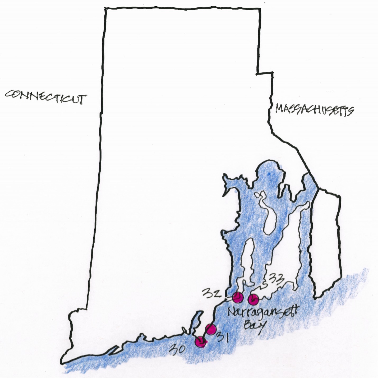
Day 20 Wednesday
Warwick, Rhode Island, for the night
The states are so close together here it’s sort of like traveling in Europe only more so. I barely have time to finish my coffee and cinnamon roll before I’m in Rhode Island and down to Point Judith where lurks Point Judith Lighthouse, well hidden behind another of those chainlink fence.
Right next to Point Judith Lighthouse is Point Judith Life Saving Station. I admit it’s not a lighthouse, just looks like one with a watch tower typical of life saving stations.
The famed Beavertail Lighthouse is not faraway, but I have to get back on US-1 north to RI-138, across Narraganset Bay to Jamestown Island and on to Beavertail Island. Fog signals were first tested atBeavertail Lighthouse—Diboll’s bells and trumpets. Steam powered whistles were also tried, but they sounded just like ships’ whistles and led to confusion as you can imagine.
I Drive back up Beavertail Road, cross the short bridge into Jamestown, get on the Claborne Pell Newport Toll Bridge, finish crossing Narraganset Bay, and drive down to Stalnaker Beach where I find Castle Hill Lighthouse perched high on a ledge guarding the bay. It’s a popular place, lots of beachies walking by, but nobody bothers me.
Swordfish dinner tonight at Ironworks, but worst Martini ever. I reflect on the day—four sketches out of the 22 claimed by Rhode Island. Too bad so many are out on islands. Next trip I’ll bring my canoe. A significant day, however, I’ve now been to all 50 states. Hooray!
Maine Roadtrip Part 7: Massachusetts
Day 21 Thursday
Wareham, Massachusetts, for the night
Massachusetts is my treasure trove of lighthouse sketches—18 in all. In New Bedford, Massachusetts, I search for Clarks Point Lighthouse, and out by the water treatment it sits well hidden atop what’s left of the old Fort Taber.
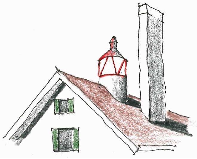
Out in the Buzzards Bay I spy a sparkplug style lighthouse but I don’t know the name so I simply call it…Sparkplug Lighthouse.
I bypass New Bedford but note that by the 1850’s it was in close competition with the island of Nantucket for the title of whaling capital of the world.
It’s only a dozen miles to Ned’s Point Lighthouse, but takes half an hour.
Just across the bay stands Nobska Point Lighthouse.
I backtrack to Wareham, Massachusetts, and spend thenight at the TownePlace Hayatt, no Holiday Inns around here. I feel prettychipper, really good sketching day—no shutouts—five sketches. Vel’s FamilyRestaurant and Lounge for dinner. Vel isn’t around, but my waitress makes agood Martini and pours the remnants in the shaker into a separate glass for me.That separate glass seems to be a somewhat standard practice around here.
Day 22 Friday
Eastham, Massachusetts, for the night
Wing’s Neck Lighthouse looks occupied so I don’t get too close.
On to Hyannis Harbor Lighthouse.
I toot on to West Dennis which in fact is just aneighborhood of Dennis, Massachusetts. The West Dennis Light is mountedon top of a massive motel operation. I’m sitting in the parking lot sketchingwhen a fellow comes up to me, “What are you doing?’
“I’m sketching the lighthouse.”
“You know this is private property.”
“Do you want me to leave?”
“No, just sayin it’s private property.”
“Okay, thanks.”
Finishing up my interrupted sketch, I go inside tothe Waterfront Restaurant, find a nice table on the deck overlooking the ocean,and order up fish and chips.
Tonight and tomorrow night I’m at the Viking Shores in Eastham, Massachusetts. Nothing to write home about, but just down the road is Caroline’s Bar & Grill, a ten star restaurant. Caroline is the seventyish maître d’, and she is hell on wheels, running her legs off. The place is packed on Friday night, but even without a reservation she finds me a booth. I make a 7:00 reservation for tomorrow night. It’s a Saturday.
Day 23Saturday
Eastham, Massachusetts, for the night again
I’m up in the morning and find I’ve got only one lighthouse to sketch today. Planning a trip like this isa bit of guesswork. There are unknowns like the length of time it will take to find a lighthouse, getting lost, weather. I drive north toward the Highland Lighthouse, looking for a place for breakfast, and I find the best cinnamon rolls I’ve ever had, better than the Holiday Inn Express even. I take a rolland a mug of coffee and go sit on a bench and have a taste delight while I watch the waves come in. My fingers are so sticky I have to go back inside and wash my hands.
There are three more Cape Cod lighthouses that I’d like to see, Long Point, Wood End, and Race Point. But they’re accessible only by boat. So I head on up to Providence town and sign up for a whale watching cruise which will take me past these lighthouses.
My expectation is to see the three lighthouses. I’ve been on whale watching boats before, and usually there aren’t many, if any, whales to watch. But I’m surprised. Humpbacks swim, and some breeding, in circles right next to the boat. And Short-beaked Saddle BackDolphins follow the boat. And, oh yes, I see the lighthouses.
That night I show up at Caroline’s for my 7:00 reservation, but the booth isn’t ready. Caroline seats me at the bar next to a couple of her friends, and she buys me a Martini. Her friends are locals and we have a great chat. They eat here every Saturday night and sit at the bar during tourist season and in a booth when the flat landers are gone.
Day 24 Sunday
Revere, Massachusetts, for the night
I can’t find the cinnamon roll place this morning. Ugh! Had to settle for Egg McMuffin, orange juice, and coffee. I round the cape side of Cape Cod and find Scituate Lighthouse, which I classify as a vase style lighthouse.
I overshoot Revere and sketch Fort Pickering Lighthouse which stands at water’s edge, but a fence blocks a close view.
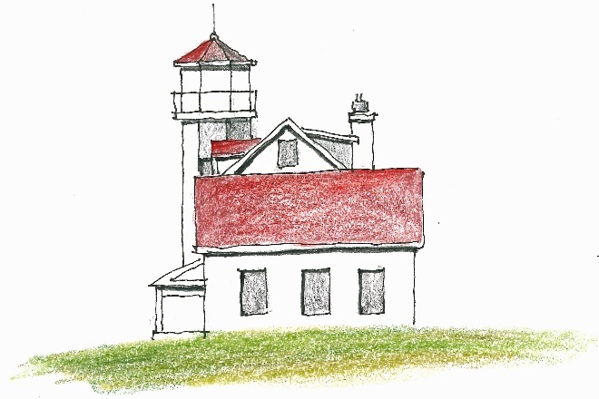
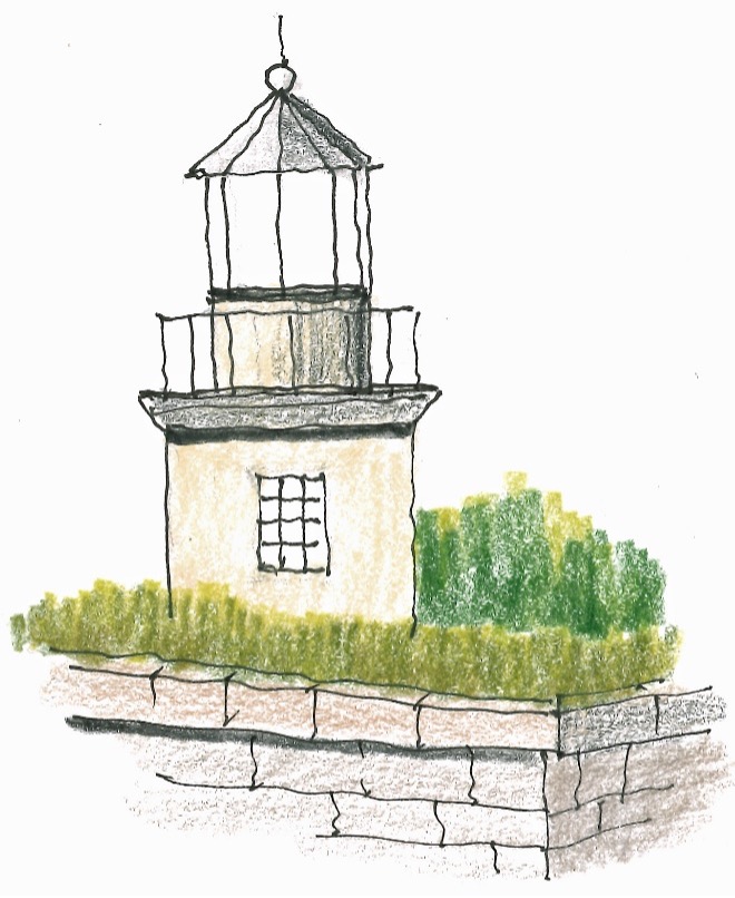
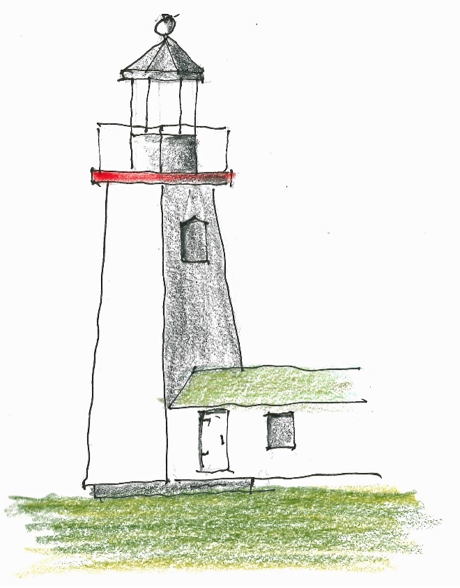
Hospital Point Front Range Lighthouse is in a residential neighborhood and access for sketching is easy. Sketching is not easy, however, because the structure is a jumble of add on’s to the original building. I don’t have patience to sketch them all.
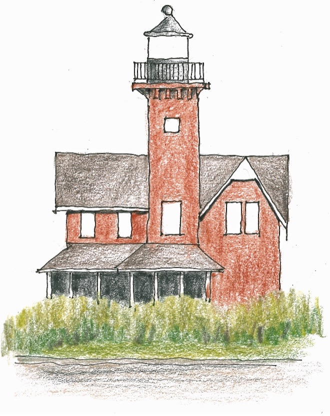
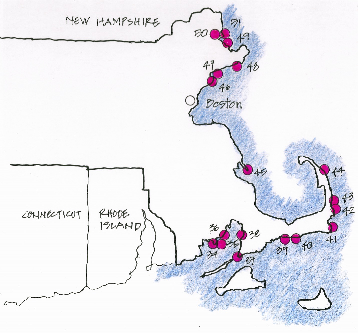
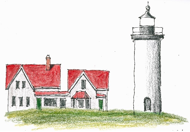
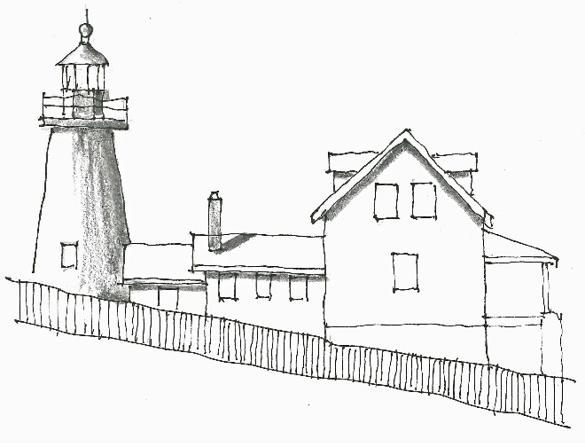
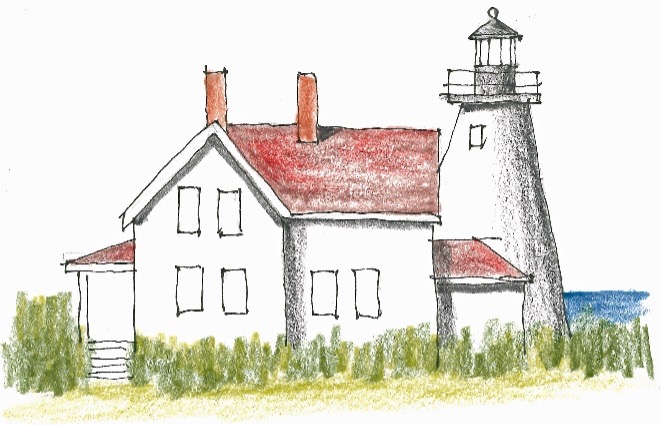
#47 The 1871 Hospital Point Front Range Lighthouse helped mark the entrance to Salem Harbor. A rear range light was placed atop the steeple of the First Baptist Church in 1927. The Town of Beverly,Massachusetts, donated a couple acres on Hospital Point where there had been a hospital to treat small pox. The lighthouse was automated in 1947 and the keepers’ quarters was used for a time as residence for the commander of theFirst Coast Guard District.
Circling back to Revere, I arrive by 4:00 in time for a nap. I start reading In the Heart of the Sea: The Tragedy of the Whaleship Essex, the shipwreck that inspired Herman Melville. I bought this book at Highland Lighthouse knowing I’d finish Titanic Survivor: TheNewly Discovered Memoirs of Violet Jessop Who Survived Both the Titanic and Britanic Disasters before the trip was over. It’s a lovely book.
Day 25 Monday
Seabrook, New Hampshire, for the night
Plum Island Lighthouse was just up the road in the midst of a large lawn. I gave it a green door because gray was just too boring.
Later at Eastern Point Lighthouse, a car with Maryland plates pulls in behind me. “You guys do have the best crabcakes,” I blurt out.
“This is a rental, we’re from California.” One of the women was a city planner and worked with architects a lot and she liked them better than civil engineers—but who wouldn’t.
Getting close enough to make a sketch was fraught with difficulty, uneven route over wet round stones. The dilapidated buildings and lighthouse are surrounded by the ubiquitous chain link fence.
Newburyport is a charming place. Newburyport Harbor Rear Range Light is right in the middle of town. I sit across the street, and an old grizzled guy comes by to talk. He chain smokes and tells me about his girlfriend, graphic designer.
Just as I’m finishing the sketch another person stops by to admire and talk. Peach Goddard is a muralist who’d been selected as one of five to paint five blocked up windows in a building just up the alley. She takes a picture of the two of us in front of her gorgeous mural.
Just a block or so away is Newburyport Harbor Front Range Light. As I sketch another guy comes by. Max is chair of the local arts board. Yet another guy, Steve stops to talk. This is a friendly place, Newburyport.
I have delicious piping hot clam chowder on the terrace at the Starboard Gallery in Newburyport and drive on to the HIXHampton. Dinner at the Sea Ketch in Seabrook, a beachy kind of place. I orderLobster Rangoons (chopped imitation lobster meat in wonton wrappers) on the upper level. Because I couldn’t figure out how to pay for street parking, I want to be able to see the tow truck and take remedial action. My Romanian waitress is studying to be a physical therapist. Thus endeth my Massachusetts lighthouse sketching.
Maine Roadtrip Part 8: Maine
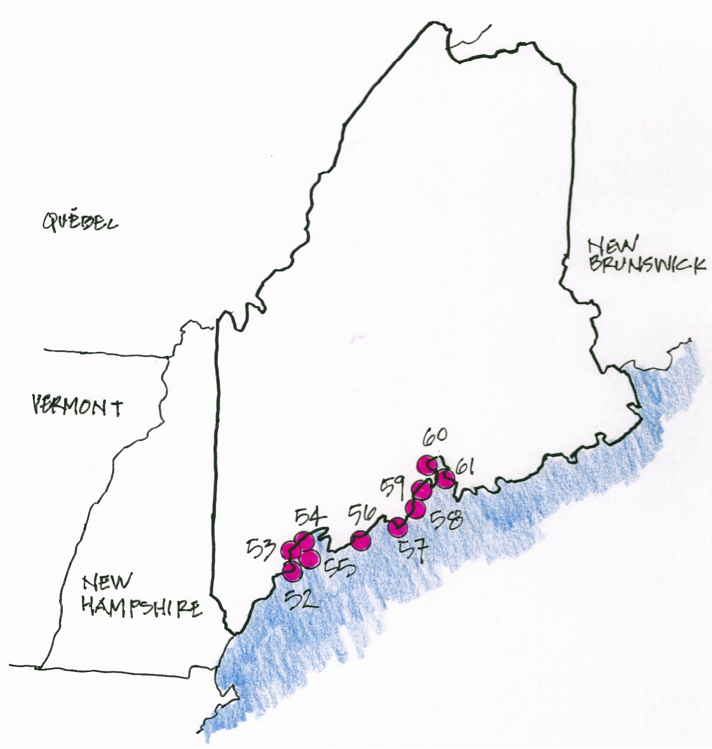
Day 26 Tuesday
Freeport, Maine, for the night
Right in the middle of a residential area I come across the front and rear range Cape Elizabeth lighthouses. I pull off the road and park next to a construction site. Three guys are trying to place abeam and column for a house. Back home two guys would have completed this in the half hour it took me to set up, sketch, and take down my kit, but not these guys.
For me sketching first thing in the morning is ajoy. It gives me something to look forward to besides the cinnamon role and the drive.
Portland Lighthouse was awash with people. I sat and sketched the Portland Head Lighthouse as they milled about and ignored me.
Year after year, through all the silent night
Burns on forevermore that quenchless flame,
Shines on that inextinguishable light! Today the Town of Cape Elizabeth owns the lighthouse, but the Coast Guard has an easement allowing them to control and maintain the light itself.
The sparkplug style Spring Point Ledge Lighthouse marks the end of a long breakwater which I didn’t want to walk, so I sketched from some distance.
After stopping for directions at a flower shop, I make my way five miles up to Bug Light Park across the Fore River fromPortland, Maine. The Bug Light, also known as the Portland BreakwaterLighthouse, is a curious sight out on the end of a breakwater. Lots of people are enjoying the park and the sunny day.
Pemaquid Point Lighthouse is an interesting set of buildings connected to the tower on a steeply sloping site. While sketching, a woman approached me to chat. She’s a painter, and she and her husband are spending a week at the lighthouse like they did last year. She says unlike other lighthouses, this one is not haunted.
I eat at the Royal River Grill House in Yarmouth which is on, of course, the Royal River. Halibut, risotto (my fav), blood orange dressing on arugula. A long day—five sketches.
Day 27 Wednesday
Belfast, Maine, for the night
The side view of Rockland Breakwater Lighthouse is more dramatic than the view I sketch, but you can see the side only from the water. I sketch from a distance—who wants to walk an uneven surface of the breakwater for nearly a mile?
Owls Head Lighthouse is a different matter, but it is up a steep set of stairs, and to set up my chair is to risk falling over backwards and breaking my neck. But I prevail. Rose of Sharon is in bloom, and the gift shop is full of people.
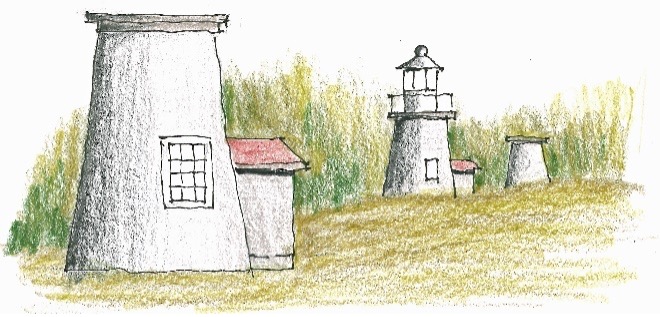
A couple more sketches and I can wrap up the day and the trip. Fort Point Lighthouse is the first and the second is Dice Head Light.
At Dice Head Light I meet a teacher who tells me she’s 38 with two kids who have jobs. She’s moving to a different town to teach. Why do people want to tell me these things—I just want to sketch.
My last night in Maine. Dinner at the Nautilus Seafood & Grill. Sit at the bar to wait for a table. Meet Sue, the woman next to me. She just quit her job as a middle school teacher. She had triplets who are all doing well. People are a bit more conversant at the bar, but what am I, Father Confessor?
I order the lobster dinner, and with the assistance of my helpful waitress I get at it. A little scary to look at, difficult to address, but delicious.
Another long day with another five sketches. Maine lays claim to 65 lighthouses, the most in New England, but nothing compared to Michigan which offers up 129. I don’t do justice to Maine’s lighthouses, but in my defense, many are on islands and reachable only by boat.
Tomorrow Lake Champlain.
Maine Roadtrip Part 9: New Hampshire,Vermont, Ontario, Michigan, Wisconsin
Day 28 Thursday
Burlington, Vermont, for the night
No cinnamon rolls at the Fireside Inn in Belfast soI move on to Traci’s Diner at the recommendation of the desk clerk. I order a short stack of blueberry pancakes with two eggs over medium and coffee. Delicious.
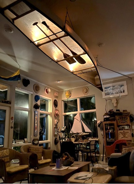
I’ve decided to hang up my Old Town canoe after 30 years of canoeing in the Boundary Waters and another 20 on my lake. It’s time—I don’t want to fall getting in or out. But by hang up I mean literally hang it from the ceiling of my big room. I’ve cleaned it up, and now I just need new Old Town decals to paste over the old faded ones.
I drive up to Old Town, Maine, where the canoes are made, and knock on the locked glass door of what looks like a shuttered showroom. A fellow opens the door and says, “The retail sales operation has been closed since Covid.”
“Well, I’ve cleaned up my Old Town ‘Columbia,’ andI’d like to get a couple Old Town decals.”
“I can’t promise anything, but I’ll make a couple calls.” I cool my heals sitting on the steps. Pretty soon he opens the door and hands me two decals. “Here you go.”
“Thank you very much.” I do have an abiding belief that people are really good at heart. Well, maybe not all people, but most.
The drive down to and across New Hampshire is one of the most beautiful in the world. White pine forests punctuated with mountains. The sky is unblemished blue.
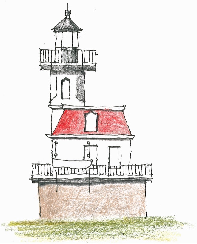
In Burlington I look up the Shelburne Museum which is an acreage with multiple historic buildings and a ship even. Electra Havemeyer Webb, founder and benefactor of the museum, had the Colchester Reef Lighthouse taken apart piece by piece and relocated to the museum. It’s such a picturesque lighthouse—simply charming.
This is in fact the last sketch. The party’s over, it’s time to call it a day. But wait, the trips not over. I’m looking forward to seeing my second wife’s kids in Wisconsin. Their mother Trudy died from a brain tumor when they were in their teens. But first I have to traverse Lake Champlain and then Ontario.
Day 29 Friday
Kingston, Ontario, for the night
I make my way across Lake Champlain with help from Apple Maps—there are bridges. I drive down the St Lawrence Seaway to Ogdensburg and then cross into Ontario. “Why are you going to Canada?” the uniformed passport checker asks.
“To get home without fighting my way around Chicago.Anyway, it’s the shortest route.”
“Okay, have a good day.”
I get so tired of people telling me to have a good day. I should get to like it—it’s a lot better than some things they could tell me to do.
Downtown Kingston—not the one Harry Belafonte sang about—there seem to be plenty of places to eat but no places to park. I find a parking structure at the Delta Hotel, the upper end of Marriott. I get a stall and find the Aqua Terra. It’s packed solid, but they let me eat at the bar, soI do. “What’s going on? Lot of people here.”
“Friday night of Labour Day weekend and also colleges starting up. Busiest weekend of the year.” I’m at the bar pretty much alone. None of these high tone folks want to confess to an old reprobate like me. I order a Martini, bread ($8), pan seared scallops and sticky toffee pudding. The most expensive meal of the entire trip.
Day 30 Saturday
North Bay, Ontario, for the night
The beauty of Vermont and New Hampshire returns fora while. Maples amid the spruce are beginning to turn, Bracken fern brown, goldenrod lush. Moose warning signs, but no moose did I see. Vehicles laden with colorful canoes and kayaks, and big semis with pulpwood logs.
I eat at Average Joe’s Eatery, about half the price of the Aqua Terra. I order Spaghetti carbonara—not bad. Joe’s is on Delaney Bay in Trout Lake with a nice nice view.
Day 31 Sunday
Sault Ste Marie, Ontario, for the night
I was once married on this date, and I ponder this as I stream along on ON-17. The views are a little more barren, but blue skies.
End of the trip is approaching. This will be my last night in a motel. I’m at the View Restaurant in Sault Ste Marie. The view is of the St Mary’s River which drops 23 feet from Lake Superior into the lower GreatLakes. I can see the locks on the American side of the river. They opened in 1855 and accommodated thousands of tons of iron ore from Minnesota to the lower lakes.
What did I learn on this month long roadtrip? Well, it will probably be my last trip of this length. Without my navigation devices it wouldn’t have been possible, but they offer only a narrow view. I’m glad I have the road atlas and several Rand McNally state maps—which used to be free at gas stations, remember?
My days usually started out with one or two fabulous HIX cinnamon rolls and couple travel mugs of coffee—all consumed in the car to save time. Lunch may be some Cracker Barrel Vermont Sharp White, New York Bagel Crisps and a can of Minute Maid Lemonade out of my trunk larder. Or just another cinnamon roll.
By suppertime I’m strung out from the road, and I try for a high gastronomic delight with ambiance, but I don’t always succeed. A Martini helps ease the edge of tenseness. It doesn't really help, just makes me muddle headed, but it does improve my contemplation—I do have a good many things to look back on, and be thankful for, in my rich and varied life.
For this whole tour de force trip, my nerves have been pretty much on high alert. It's the Sketching that brings me such great peace, comfort and relaxation. It moves me into my right brain—that’s why the sketches are so whimsical and quirky. I hope I’ll always be able to sketch. It’s been missing these last three days. But visiting Jenny, Katie, and Steven will be a crowning finish to make up for that.
Day 32Monday
Hazelhurst, Wisconsin, forthe night
I’ve taken the drive from Hazelhurst to Sault Ste Marie on other lighthouse jaunts. It’s a pleasant drive on the reverse through Chequamegon-Nicolet National Forest and the fragrant smell of White Pine.
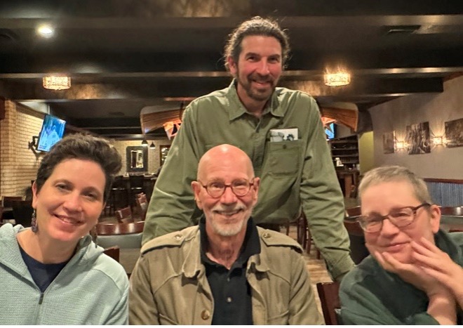
I drive to Blacks Cliff Resort, Jenny, Troy and Steven pile into Jenny’s electric bright blue Chevy Bolt and we shoot up US-51 to Arbor Vitae where we meet up with Katie and Bryan for a touching dinner with my Wisconsin step kids and spouses. A fitting close to this marathon outing.
Up until now I’d sent a text, usually around dinnertime, to family so they wouldn’t worry about me. But tonight, I was busy piling on warm sleepwear so I wouldn’t freeze out on Birchwood’s screen porch in 37 degree weather. I sleep like a deadman in the swinging bed.


Comments